Developed by the UK Centre for Ecology & Hydrology (UKCEH), the web-based tool brings together a wealth of information on the latest hydrological situation across the UK.
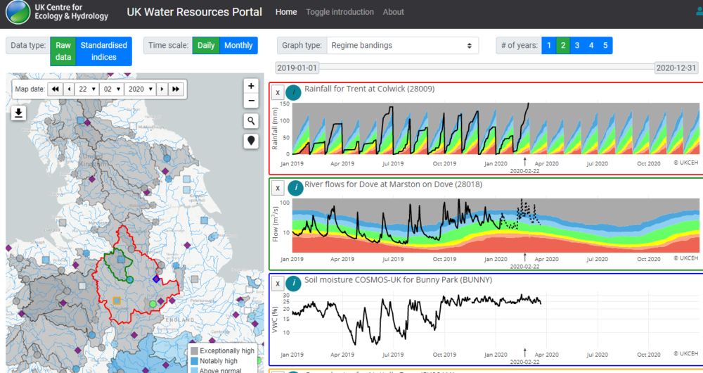
The UK Water Resources Portal provides the most up-to-date available data on river flows, rainfall, soil moisture and groundwater levels from a local to a national scale, with users able to view measurements in any part of the country by clicking on an interactive map.
In addition to providing an indication of current water resources status, and early warning of potential drought or flood conditions, it also has historical records that enable comparisons to be made with long-term averages and previous significant events from the past 50 years.
This video takes you through the portal’s features:
The portal provides access to the following data:
- River flows for England updated every 1 to 3 days via the Environment Agency’s live hydrological data service (river flows for Wales updated every month)
- Soil moisture from the UKCEH’s COSMOS-UK network updated daily
- Rainfall from the Met Office updated every month
- Groundwater levels from the relevant national measuring authority, delivered in collaboration with the British Geological Survey updated every month
The information can be viewed on layered maps, including the UKCEH Land Cover Map 2015 and the BGS Hydrogeology 625K, which, respectively, show the type of land use and geology across the UK on a 1km scale.
Most of the records for river flows, rainfall and groundwater go back to the 1960s, while the soil moisture data starts in 2014, shortly after the COSMOS-UK network was established.
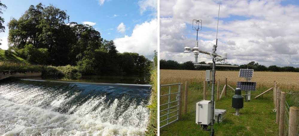
The river flow and groundwater measurements come from the UK’s 1,500 gauging stations, with the real-time data coming from the Environment Agency’s live Hydrology Data Service. Historical river flow data comes from the National River Flow Archive (NRFA).
COSMOS-UK soil moisture data provides soil moisture estimates at the field scale on a daily time step at around 60 sites across the UK for a range of soil and vegetation types. This can provide useful comparisons with local farm-scale observations of soil moisture. Work is being undertaken to use COSMOS-UK to validate soil moisture data observed using satellites, with the aim of eventually providing regular, national scale coverage of soil moisture information.
Live access to river flow data in England, directly from the Environment Agency, means that farmers have real-time access to information about the water resources available to them.
Importantly, the portal enables open access to the same information that the Environment Agency use to make decisions around flow restrictions, meaning farmers can look at the data and make plans/adjust their management strategies accordingly when flows start to approach abstraction limits.
Jamie Hannaford, principal hydrologist at UKCEH, hopes that the portal will become increasingly important for farmers as a ‘one-stop-shop’ that brings all the latest hydrological data together in one place.
Mr Hannaford said:
“Tracking the various hydrological elements – how much rain has fallen, how saturated the soil is, how full our aquifers are and how much water is flowing in rivers – will help us better monitor the development of floods and droughts, and manage them accordingly."
More from NFUonline:
- COVID-19 and abstraction returns, irrigation inspections and abstraction charges
- Environment Agency publishes revised irrigation prospects for 2020
- Environment Bill suspended but abstraction concerns remain
- Pick For Britain - post your job vacancies now
- Watch now: A message from the President
- NFU has second meeting with banks on support for the sector
- MPs urged to speak up for food and farming during crucial Agriculture Bill debate
- NFU App survey: We want your views